An Insider's Guide to Driving the McCarthy Road
The McCarthy Road is an adventurous and remote road trip that ends at one of Alaska’s most scenic and eccentric destinations. With the right information and preparation you can safely reach the small towns of McCarthy and Kennicott in Wrangell - St. Elias National Park. The road begins in Chitina, where pavement ends and the route follows the old railbed of the Copper River & Northwestern Railway, completed in 1911 to carry copper ore from the Kennecott Mines to Cordova.
How Long Does it Take?
The road is only 59 miles long, but the drive typically takes 2 to 2.5 hours.
Is There Fuel & Other Services?
Aside from several waysides with vault toilets, there are no services along the McCarthy Road. Before driving the McCarthy Road, you can stop for fuel and supplies in Glennallen, Copper Center, Tazlina, or Kenny Lake. Chitina is the last place to fuel up, stop for a meal, and make any final adjustments. There’s a small mercantile, a gas station, an art gallery, and a handful of seasonal food options. The Chitina Wayside has parking and restrooms.
Where Can I Check Road Conditions?
You can check road conditions at the Chitina NPS Ranger Station, or online.
What Are Driving Conditions Like?
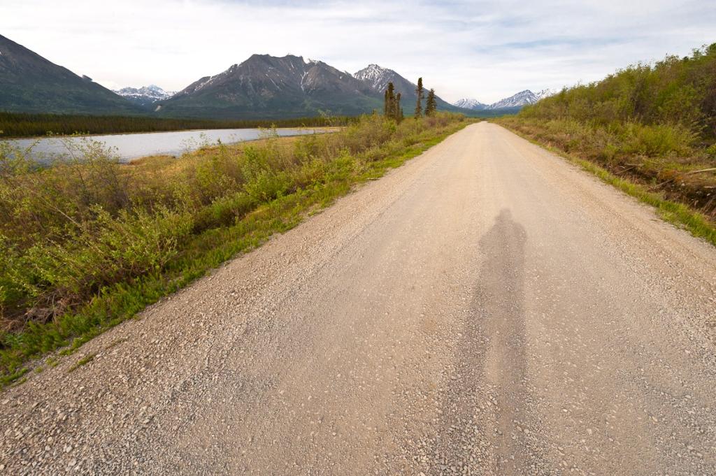
The McCarthy Road requires the driver’s attention for several reasons. Conditions change throughout the drive, with stretches of smooth gravel followed by washboard sections, unexpected potholes, and occasional sharp rocks. Old railroad spikes can work their way to the surface, especially after the road has been graded.
On this narrow road, blind corners and dust on dry days can reduce visibility, especially if you’re following another vehicle too closely. Slow and steady really does win the race on the McCarthy Road. Cautious drivers should watch their rearview mirrors and pull over to a stop to let others pass safely, or to give an oncoming vehicle enough space to go by. Landslides are possible, especially during heavy rains.
When Can You Drive the McCarthy Road?
The road is best from mid-May through mid-October. Summer offers longest days, making it easier to take your time along the way. Fall tends to be quieter, with fewer vehicles on the road and gorgeous fall colors. Winter travel is possible, but the road is not regularly maintained and conditions can become unpredictable. For most visitors, summer and early fall are the most practical times to go.
What Vehicles Can Drive the McCarthy Road?
The McCarthy Road is typically drivable for most passenger vehicles during good conditions in mid-May to late September. Higher-clearance vehicles will perform better over the bigger potholes, dips, and rocks, but four-wheel/AWD drive is not usually necessary. RVs and large campers are generally not recommended due to narrow sections, soft shoulders, and limited turnaround space. Most rental RV companies prohibit travel on this road, as do most major rental car companies. However, a handful of Alaska-based rental companies do permit travel on the McCarthy Road. Be sure to check your rental agreement carefully.
What Should I Bring?
Preparation matters here more than on most Alaska road trips. A full-size spare tire or tire plug kit is strongly recommended. Bringing extra food, water, and a bit of flexibility in your schedule makes the experience more enjoyable. Cell service is limited to nonexistent for most of the drive.
Scenic Points Along the Way
Beginning of the Road & Copper River Views
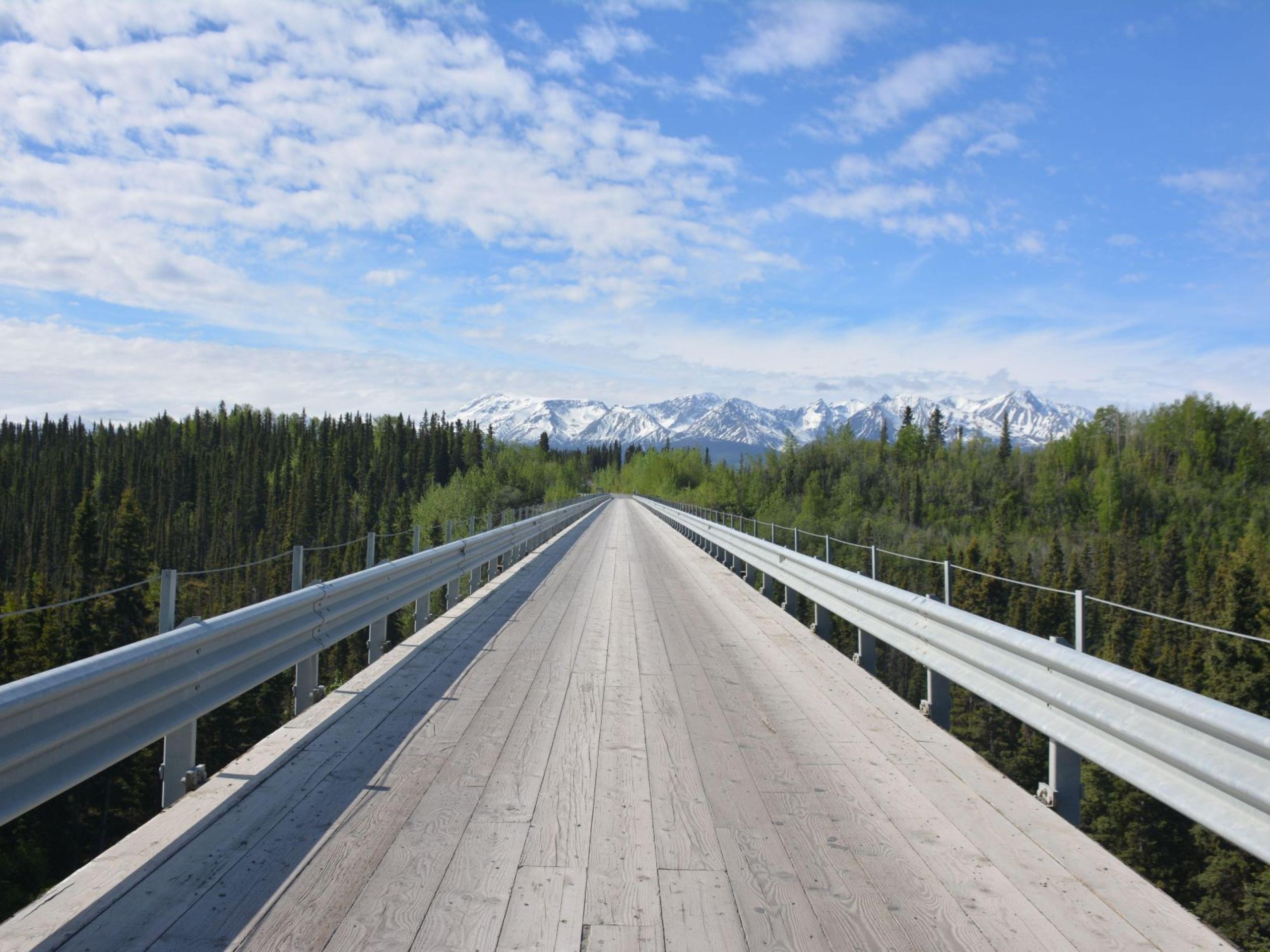
Just past the Chitina Wayside the road goes through a narrow gap known as the "railroad cut." The rocks are schist and phyllite. It was originally a tunnel, but was altered into an open roadcut. Less than a mile later, you’ll cross the Copper River over a bridge constructed in 1971. In summer, fish wheels can be seen upriver, part of a long-standing subsistence tradition. You will be tempted to stop on the bridge for a longer look around, but keep going across, and you’ll arrive at an access point to the river on the left side where you can see the fish wheels up close. On the right you’ll find the Copper River Campground with 12 sites, vault toilets, and fire pits.
Miles 10 - 12: Lake Hikes
As the drive continues, a series of short detours lead to small, peaceful lakes tucked just off the road. Around miles 10-12, trails branch off to Strelna, Silver, and Sculpin Lakes, each an easy walk and a good place to stretch your legs. These lakes are stocked with rainbow trout by the Alaska Department of Fish & Game.
Mile 14.5: Kotsina Trail
At mile 14.5, the Kotsina Trail heads north, connecting to Nugget Creek trailhead after 2.5 miles and Dixie Pass trailhead after 3.8 miles. It’s one of the first access points for those looking to venture beyond roadside stops and into the backcountry.
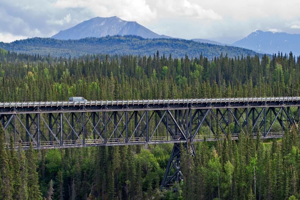
Mile 17.2: Kuskulana Canyon and Bridge
At mile 17.2 you’ll arrive at the Kuskulana Canyon and Bridge. The narrow, single-lane steel bridge above the canyon was built in 1910, 238 feet above the Kuskulana River. If you’re lucky, you may see people bungee jumping off the bridge. Do not stop on the bridge. Park in the designated pull-outs on either side and walk onto the bridge for photos. There are vault toilets on the east side of the bridge.
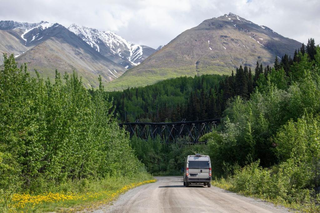
Mile 29: Gilahina River and Gilahina Trestle
Farther along, you’ll arrive at the Gilahina River and Gilahina Trestle wayside at mile 29. Built in just eight days during the winter of 1911, the towering trestle is an impressive reminder of the speed and scale of the original railroad construction. Today, it’s best viewed from the wayside, without climbing on the aging timbers. There are vault toilets at the wayside.
Mile 34.8: Crystalline Hills Trail
Near mile 34.8, the Crystalline Hills Trail offers a slightly longer break from the drive. The 2.5-mile loop provides open views of the surrounding terrain and is one of the better spots along the road to watch for Dall sheep.
Mile 45 - End of Road
The road becomes even more narrow at Long Lake, so be extra cautious when driving through this small community. As you continue toward the end of the road, stops become more spaced out. A state wayside at mile 55.2 provides restrooms and interpretive panels, while the unstaffed McCarthy Road Information Station at mile 58.6 offers updated bulletins, a short trail, and a final place to pause before reaching the Kennicott River.
What to Expect at the End of the Road
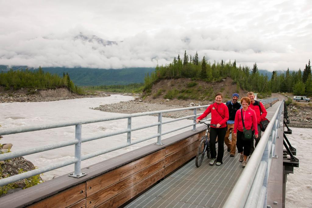
As you get closer to the end, the Wrangell Mountains begin to fill more of the horizon, and you’ll start to notice small lodges, cabins, and seasonal operations appearing along the roadside. At mile 59, the road ends at the Kennicott River. From here, vehicles stay behind for a parking fee. You’ll cross a pedestrian bridge on foot, bicycle, or ATV, with wide views of the river, glaciers, and surrounding peaks. The walk into McCarthy is about half a mile, and in summer, shuttle vans run regularly between the bridge, town, and Kennicott. The payphone at the west end of the bridge works without quarters.
The McCarthy Road is as much about the journey as the destination. With a bit of preparation and patience to take it slow, the drive becomes part of the experience.

Alaska: AKA Your Next Adventure
Where will your Alaska adventure take you? Order our Official State of Alaska Vacation Planner and plot your course.